Packed and ready to go

Wednesday, June 23, 2010

Day 15: Durango to Durango via San Juan Byway 252 miles

Today I fulfilled the second of my "must dos" in Colorado. It was a full day, as most of them have been. We were up early and went to a local bagel shop for breakfast, then on the road just after 7am. Our route was the scenic San Juan Byway which loops around the San Juan mountain range in southwestern Colorado. The San Juan's are the location for 14 of the states 54 peaks over 14,000 feet, so the scenery is dramatic. This range is also rich in silver, and most of the towns were originally mining communities.

Back when we had first moved to Tucson, Paul and I went to Cortez over Labor Day weekend to visit his father who had a summer place there out of the Phoenix heat. We had our bicycles and decided to ride from Durango to Silverton. This route is a famous bike race known as the Iron Horse Classic, because it was started to race the narrow gauge railroad. Paul's Dad offered to drive along with us, leapfrogging from spot to spot. He would stop and have coffee or read a bit of the newspaper until we went by and then pass us and find another spot to stop. Even though it was early September, it was quite chilly, and we weren't prepared for the temperature at elevation. Still, all was going well with the leapfrogging method until we approached the final climb, Molas Pass. Paul's Dad figured we were all set, and he went ahead to Silverton to wait for us there. Meanwhile, it started to rain and then the rain turned to snow. We were okay climbing, but then there is a 10 mile fast descent into Silverton and we were hypothermic by the time we finished. I've read that a true adventure sucks while you are having it, so I guess our ride ranks as an adventure. We laugh about it now.

On motorcycles, and with heated gear and no rain, the ride to Silverton was positively delightful. We followed US-550 from Durango north and stopped to take pictures at Coal Bank Pass (10,640 feet) and Molas Pass (10,910 feet). The route continues through Silverton and the town of Ouray. The descent into Ouray was very twisty and fun. At Ridgway, we followed CO-62 west over Dallas Divide (8,970 feet). CO-145 south took us toward Telluride. We took the side trip into the village of Telluride, a very good example of a Victorian Era mining town, now also known to me as the home of the $4 bottle of juice (8 oz bottle). The ski area of Telluride is a few miles outside of the village. From there we continued south over Lizard Head Pass (10,222 feet) and down into the Dolores River Valley. We continued on into Cortez to pass by the old family summer place and then stopped in town for lunch. US-160 east took us back to Durango.

For dinner, we had arranged to meet my friend Julz and her husband at a local restaurant. Julz was one of my very best teammates when I was seriously into bicycle racing. She is smart and fun to be around. I sort of lost touch with her when we left Tucson in 2005 but had heard she had moved to Durango and was getting married. Thanks to the power of the internet, I found her email address about a year ago and we've been in sporadic touch since. So I was delighted that we got to spend a few hours with her and her new husband, Sean. They are building a house just outside the village of Durango and we got a tour through that. Julz has very good taste and is an architect by training. Their house is beautiful. It should be ready for them to move into in a month or so. We'd love to come back and visit with them again.

Tuesday, June 22, 2010

Day 14: Gunnison to Durango 233 miles

We needed a shorter day, and today presented the perfect opportunity. Paul has been fighting a cold since arriving Saturday, and it was nice to give him a chance to relax. We also wanted time to visit with his Aunt Gerry who had offered to drive to Durango from her home in Cortez. She was happy to have an opportunity to shop at other than Walmart, Walgreens, Safeway, or one of two dollar stores.

We left Gunnison and headed a few miles further west on US-50. From there we took CO-149 south. This was one of the most fun roads I have been on this trip. The road twists and turns and goes up and down, but they are mostly higher speed, sweeping curves. We passed through Lake City where there actually is a lake, formed when a large part of a mountain slid down and blocked the Lake Fork Gunnison River. We were able to see the mountain that is missing part of itself when we crossed Slumgullion Pass at 11,361 feet. Next came Spring Creek Pass at 10,901 feet.

CO-149 joins US-160 at South Fork, and we took US-160 west over Wolf's Creek Pass at 10,850 feet. Paul's favorite story of Wolf Creek Pass is that he had a roommate his first year of college who decided to ride his bicycle home from Tucson to Wisconsin. Leaving in June, the roommate still got snowed on going over the pass. We didn't get snowed on today, but it was quite chilly (50's) and very windy. We had to be quite careful on the descent not because of the curves and steep grades but because of the wind. It was good to get down into the valley. The route passes through Pagosa Springs and leads to Durango.

Durango is a railroad town, now best known for the Durango & Silverton Narrow Gauge Railroad. The train at one time served to haul ore out of mountain mines to the smelter located in Durango. The railroad is currently a major tourist attraction, along with fishing and rafting on the Animas River. We are in Durango for two nights.

Monday, June 21, 2010

Day 13: Granby to Gunnison 303 miles


We got a good, early start, around 6am, wanting to get up Mount Evans before there was much traffic. It was about 34 degrees, so we were suited up in our heated gear. We did make a stop for breakfast just a few hundred feet down the road from our lodging. Ian's Mountain Bakery in Granby was awesome. We were greeted by Ian himself, a very loquacious guy who is a magician with pastry. He offers breakfast burritos, breakfast pockets and a number of different types of pastries. We sampled his heartier fare and then shared an apple turnover. We also got a blueberry scone "to go" for a snack later. It was about a three hour ride to Mount Evans, down US-40 through Fraser and Winter Park. Then a short hop on I-70 east to Idaho Springs, and onto the start of the Mount Evans ascent, CO-103. Once we turned onto CO-5, the Mount Evans road, there is a ranger station. The fee was $3 each, paid to a very friendly, helpful ranger who seemed truly happy to be doing his job. Then we did the 14 mile Mount Evans climb. The road is tortuous in places, especially near the top, and the pavement isn't always in great shape, owing to avalanches and landslides, no doubt. We were quickly above tree line with snow in many areas still present. There are numerous 1st gear hairpins.

I had hoped to see the famed mountain goats, and sure enough, there were several of them hanging around the parking lot and climbing on the walls surrounding the lot. They don't seem particularly tame, but are not intimidated by people, either. We hung around for a while, taking photos and trying to identify mountains off in the distance. It was pretty hazy. Supposedly one can see 200 miles on a clear day. We couldn't even quite make out Denver, about 40 miles away. I started to feel lightheaded from the elevation, so we started down.

We retraced our route back to I-70 and headed west through the Eisenhower tunnel and then south on CO-91 toward Leadville. We crested Fremont Pass just before the mining town of Climax where the main product is molybdenum. We went on through Leadville, a classic western silver mining town. Leadville is the highest elevation city in the US at 10,152 feet and is near the headwaters of the Arkansas River. We were headed for Gunnison, but were way ahead of schedule. On a whim, we decided to take a whitewater rafting trip.

We continued south on US-24 to Buena Vista, a town I had passed through on Friday on my way to Denver. We chose at random the first rafting company we came to, Kodi Rafting Tours. They had a 3 hour tour leaving in 30 minutes, so we signed on. After a quick change out of motorcycle gear and into rafting gear, we were ready. We became clients on one of the decrepit school buses I have mentioned in a couple of previous posts. On the bus ride to the launch site, we were told all of the grizzly safety details. In reality, the trip was quite tame. It was supposedly a class 3 (of 5) river, but there was only one short section that was exciting. All in all, it was fun and great to get off the motos and on the water.
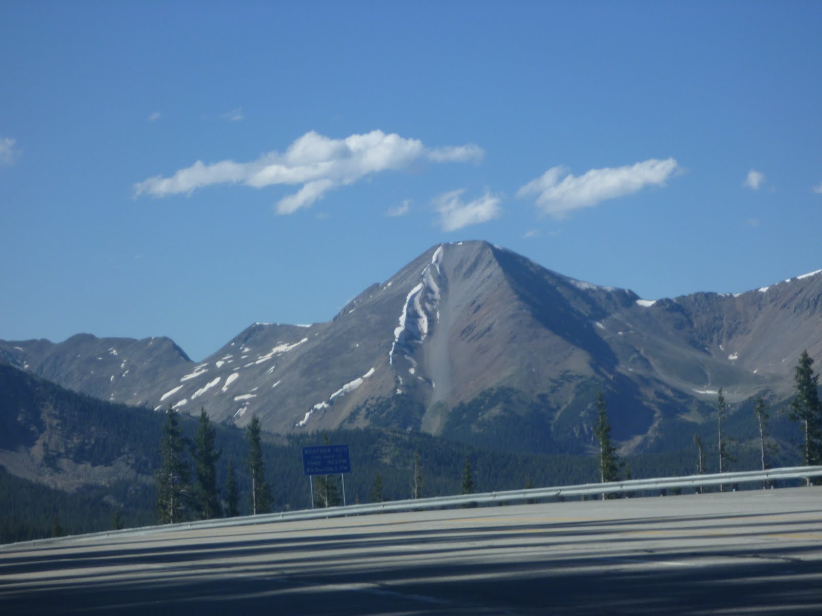
After returning to the tour company base and getting dried off and redressed, we continued south on US-285 to US-50 west. We crossed one more major pass, the Monarch Pass, which marks the continental divide in the southern part of Colorado. This is the view looking south from Monarch Pass. We rode on to Gunnison, home of Western State College of Colorado.


Sunday, June 20, 2010

Day 12: Fort Collins to Granby 267 miles

We spent the morning on a pilgrimage of sorts. I only had two "must dos" for Colorado, and we took care of the first one today. Several years before her death, Lucinda spent a summer at the Shambhala Mountain Center in Red Feather Lakes, CO. I mentioned in my opening post that my sister was a practicer of Tibetan Buddhism, and the SMC is one of only a few places in the US where Buddhists can live immersed in their practice. I wanted to see where she had been so happy, and to visit the Great Stupa of Dharmakaya that is there.

Red Feather Lakes is about an hour northwest of Fort Collins. We followed US-287 to CR-74E. A few miles shy of the village of Red Feather Lakes is a good dirt road which leads to a Boy Scout Camp and then to the Shambhala Mountain Center. This area is a broad intermontaine meadow, made colorful with wild flax, iris, lupine and others. We parked and took the approximately 30 minute hike up to the Great Stupa.

The Great Stupa of Dharmakaya is one of only a few examples of sacred Buddhist architecture outside Asia. It is supposed to represent the body, speech and mind of the Buddha. The building took 15 years and is still ongoing. There are many symbolic features to the building. The only ones I remember are the four entry ways that represent the four elements: red=fire, yellow=earth, blue=water, green=wind. There is an immense statue of the Buddha inside. Buddhists sit and meditate. There are also relics important to Tibetan Buddhism. It's a beautiful building even if its full meaning is lost to me.


We left the SMC and retraced our route back out to CR-74E to US-287. From there we took CO-14. We'd gone about 60 miles after leaving the SMC when we saw a sign, "Shambhala Mountain Center, 5 miles". The sign directed us onto the other end of the dirt road we had been on over an hour ago! At least our ride was scenic! CO-14 follows the Cache la Poudre river for miles. This is another river heavily used by rafting companies. We didn't get behind any decrepit school buses, only very slow moving cars. I had to keep reminding myself not to stress over the slow car, there would only be another slower one up ahead. We finally got clear road and made our way to Walden.

Just before Walden we stopped at an interpretive site for the Arapahoe National Forest. The signs explained how the land was settled, first for mining then for ranching and logging. The land is very fertile but the growing season is only 44 days, so there is no agriculture other than some haying. I felt like I was on top of the world except off in the distance you can see even higher mountains. We were at over 10,000 feet here.


From Walden, we continued southwest on CO-14 and took US-40 west for a few miles. This took us over Rabbit Ears pass which marks the Continental Divide. We backtracked the few miles and continued on US-40 south and east to Granby. The motel we chose, Trail Riders Motel, is small but caters to motorcycles. Upon check-in, the proprietor gave us cloths to clean our bikes and told us where to find small plywood blocks to prevent the kickstands from sinking into her soft pavement. We are here along with 6 or more Harley riders. We are planning to leave early, hopefully before they do, so we don't have to endure their noise!

Saturday, June 19, 2010

Day 11: Denver, Co to Fort Collins, CO via Estes Park 177 miles

The Colorado portion of the adventure has begun!

Paul wasn't due in until early afternoon, so I spent the morning at the Denver Botanic Gardens. This was high on my priority list of gardens to visit. I was not disappointed. This particular garden incorporates both local and regional native plants as well as those that survive in Denver's unique and challenging environment. Very little rainfall (about 6 inches per year), altitude, temperature extremes and punishing winds means plants must be tough to survive. I was surprised at how many plants I am familiar with from my own garden are also suitable to Denver.

In addition to the wonderful gardens and displays of plants, there was also a special exhibit of the work of Henry Moore, a British sculptor who was inspired by the natural environment and derived pleasure from seeing his works in a landscape setting. There were 20 huge works spread throughout the gardens.


Paul and I had agreed to meet at the motorcycle rental place, Colorado Tourbikes. He was going to take a series of city buses from the airport to get there. I arrived early and was sure we weren't in the right place. I was in a neighborhood, just houses, surely no businesses. I called Paul to warn him, but he was just five minutes away on the bus, so got off where he planned. I rode one block over to meet him. It wasn't exactly the reunion I planned on, but I was still glad to see him! I called the company only to be told that their actual location is somewhere else (fortunately only a couple of miles away). I was able to ride over there and Paul set out to walk, carrying his luggage. I dispatched the rental owner's wife to retrieve Paul. Never did they communicate that we should go somewhere other than where we shipped Paul's gear. Oh well!

At least the motorcycle was available as promised and we got Paul geared up and packed up. He is renting a BMW R1200RT which is a little different from the R1200GS he owns.

We set off across Denver on city streets then onto US-6 to CO-119. CO-119 climbs and descends various mountains. Most of the time there is a slow moving car in front, but we occasionally got clear road and enjoyed it! At the town of Nederland, we took CO-72 to CO-7 which forms the eastern edge of Rocky Mountain National Park. We passed through Estes Park which is now more than just a crossword puzzle answer to me.


From Estes Park we took US-34 which descends down the eastern flank of the mountains into the valley at Loveland. From there it was a quick ride up I-25 to Fort Collins.


Friday, June 18, 2010

Day 10: Santa Fe, NM to Denver, CO 362 miles

I had a great visit with my brother in Santa Fe. Wednesday night we were able to do a little hike up into the mountains. We could see smoke from the wildfire currently burning up near Los Alamos. On Thursday, John spent the entire day with me when he should have been working (he does custom cabinetry and furniture, absolutely museum quality work). By begging, borrowing and renting, he was able to gather enough equipment for me to be able to go on a bicycle ride with him. I had on my own glasses, shorts, socks, and sports bra. The bicycle and helmet were rented, the shoes were borrowed from a friend of John's and the jersey and gloves were John's.

We did a 50 mile route north to the Pojoaque Indian reservation and back. Now, I could make all kinds of excuses (I live at sea level and we were riding at 7000+ feet elevation, the bike didn't fit me right, the shoes were flexy, I haven't ridden for 9 days, etc., etc.,) but I was slow and I suffered! John very graciously waited for me and constantly rode in front to block the wind. I loved being out getting some exercise, but it was painful. Despite drinking far more water than I would ordinarily, my legs were heavy and I cramped badly. But I would do it again in an instant.

I had dropped off my motorcycle at BMW of Santa Fe in the morning to have the oil and filter changed. They had it done when promised and it seemed to run better on my short ride back to John's. The moto has been doing great the whole trip. It doesn't burn oil and the tires I had put on just before the trip (Michelin Pilot Road II's) haven't lost air pressure and have performed beautifully.

After saying a teary goodbye to John (seeing him reminds me that we are only two now instead of three), I headed north on US-285 toward Colorado. The high desert terrain is pretty stark. There are several native american reservations or pueblos in northern New Mexico and eking out a living in such a landscape has to be very difficult. Early on I did cross the Rio Grande, a river I usually associate with Texas.

Almost immediately after crossing the New Mexico - Colorado state line, the mountains become visible on the horizon. Despite some haze, one of the first things I could see were the white caps of the higher peaks. It's hard to fathom there is still snow this late into June when the valley floor temperatures are in the 90's, but it's also hard for me to fathom 14,000 foot peaks! I stopped briefly in Alamosa, the first town of any size on my route. There is a good visitor's center there very well stocked with maps and tourist literature. From Alamosa, I took the shorter CO-17 which rejoins US-185 further north. Everywhere I looked was worthy of a postcard. Unfortunately, there is nowhere safe to pull off the road to take pictures. Hopefully some of the smaller roads we will be on in the next week will have less traffic.

Around the area of Poncha Springs, traffic really started to bog down. There are numerous rafting companies in the area, taking advantage of rapids on the Arkansas River. They use decrepit school buses towing trailers full of rafts to take clients to the launching point. They also seem to have a maximum speed of 30 mph. It was around this time that I noticed how many RV's were on the road and of the remaining vehicles, only about 1 in 10 was a "car" not a pickup or SUV. The pattern continued as I got closer to Denver.

US-285 eventually turns more east. I stopped one more time about 30 miles outside Denver for what I thought would be a quick turn around. I only needed water. One guy started talking to me before I had even shut the engine off, admiring my moto. Another one inside the store carried on for the longest time about all the places outside of Colorado I should ride. When I finally got back out, a third guy stopped to ask me about my motorcycle. I'm glad it attracts so much admiring attention, but I just wanted water and to get back on the road!

These last 30 or so miles descend and descend down to Denver. The temperature rose about 1 degree for every 2 miles. A good distance and what would have been the most fun part of the descent was on grooved concrete road. They must do this to improve water run-off, but it made it a little sketchy on two wheels. Safely down, I slogged across the suburbs of Denver to my hotel. Paul arrives tomorrow and I am so looking forward to seeing him.

Wednesday, June 16, 2010

Day 8: Lubbock, TX to Santa Fe, NM 389 miles

I'm in Santa Fe, staying with my brother John and his partner Cathryn. The major mission of my journey is complete, with Lucinda's ashes safely delivered. There have been tears along the way, and surely more will follow, but I'm so happy I've made this journey on my motorcycle.

I took my time leaving this morning, rolling out around 8am. For a small city, Lubbock has a surprisingly extensive freeway system. Fortunately, the Zumo guided me through several sets of on and off ramps and set me headed due west on a farm road. Initially, I thought this might be a notorious GPS trick, leading me astray to dead end at a cattle watering tank. But in reality the road was pretty decent with a 70 mph speed limit and almost no traffic. I was able to stop on the road and take some photos without being in danger of impeding anyone else.

Fairly early on after leaving Lubbock, I started to smell oil. I was looking for a place to pull off to see if the moto was leaking when I noticed the oil rig. Pretty soon there were many oil rigs. Sometimes they are in undeveloped fields like the one above. Sometimes they are right in the middle of crops. The air was pretty pungent for a number of miles.

After a while I lost all signs of life, no cattle, no oil rigs, no agriculture. This is west Texas, just before crossing into New Mexico on US-380. New Mexico quickly turned less green, more desolate and hotter, up to 95 degrees.

I decided to stop in Roswell, sight in 1947 of a supposed UFO crash. There is a museum and "research" center which is kind of hokey and kind of interesting. They attempt to lay out all the known "facts", including eyewitness testimony. There is enough information to turn believers into skeptics and skeptics into believers. The "official" story is that debris found was simply a weather balloon. This picture shows my favorite humor. It's a little hard to read here, but identifies everything as a "weather balloon" except the weather balloon which is identified as "swamp gas".

I took the time in Roswell to get an early lunch, my first Mexican food of the trip. I also bought a few postcards and got them written and mailed off. From Roswell, I took US-285 almost all the way to Santa Fe. There is only one town, Vaughn, which comes at about half distance. From here north, the wind was crazily strong coming from the west, and temps were in the mid-90s.

Tomorrow is a rest day. The moto is going to the good folks at Santa Fe BMW for an oil change, and I will hopefully get some exercise in the form of a hike or bicycle ride with my brother.